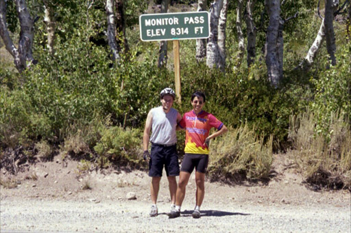
Arturo and Erhhung at the top of the pass
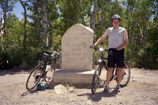
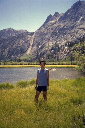
Arturo next to the old sign at the top of the pass
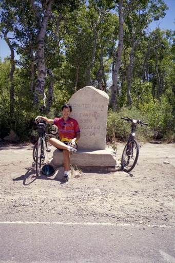
Erhhung next to the old sign at the top of the pass
|
|
August 11th-12th, 2001 Monitor Pass
Start/End: Woodfords June Lake Loop
Start/End: junction of HW 395 and HW 158 |
On Friday August 10, I picked up Erhhung at his home in the East Bay and we headed to the mountains. After 5 hours of driving, we arrived at the Silver Creek Campground just off Highway 4 near the town of Markleeville. This is a nice campground at 6800' with pine trees in a mountain canyon setting with primitive facilities (cold water and vault toilets). The campground is splited by HW4, but there is little traffic, so the noise is no much of a problem (however, this is a safety issue if traveling with kids). We go there quite late and somehow, we manage to get ourselves confused and we set the tent at the wrong campsite. Fortunately, it was a self standing tent, so moving it to the right site was not much of a problem.
The Monitor Pass Classic tackles, of course, Monitor Pass, (8314 ft) "the famed Markleeville Death Ride's toughest of five mountain climbs." It "charts a formidable and diverse route by starting in Woodfords (also the start-finish of the Diamond Valley Ramble), climbing the toughest of Alpine County's mountain passes, and then traveling onward to Nevada before eventually winding its way back to Woodfords. (the actual Death Ride travels over both sides of Monitor as well as Ebbetts, Luther, and Carson Passes)."
The climb over Monitor Pass is a constant, never-ending, 10-percent grade for 9.6mi. Add to this the high elevation, and you'll understand why we had to stopped every couple of minutes to regain our breath. After cycling for about 2 hours, we finally reached the top of the pass. From there, it's a quick, exhilarating descend to Highway 395.
On 395, we quickly arrived to Topaz Lake and the Nevada state line (clearly marked by a casino). From here, we fought the rolling hills and the 100-degree air temperature until we arrived to Centerville. From there, we ascended again back to West Sierra using Carson Pass. This pass is not nearly as hard as Monitor Pass and we were surprised when Woodford appeared around the corner.
Arturo next to the old sign at the top of the pass
Erhhung next to the old sign at the top of the pass
The ride starts with a climb Oh! Ridge before dropping into the resort town of June Lake where we stop for Popsicles and ice cream (in a store where Erhhung was short-changed, and I was overcharged). From there, we drop (steeply at times) to the shore of each of the lakes, until we reached HW 395.
By Mono Craters, we saw a huge clouds. We wondered about what it was (an eruption? hot springs?) and we headed toward the cloud to Mono Lake. The ride was uphill, but a nice back wind allowed us to get to The Mono Tufa in no time. Unfortunately, the cloud was a forest fire and the police evacuated the Tufa area and we had to head back immediately. Now, the nice back wind turn into a front wind... Even though it was downhill, we had to pedal hard to keep moving. We were not happy campers there. Back on HW395, we were in a better angle with the wind and we pedal back to our starting point.
Erhhung by Silver Lake
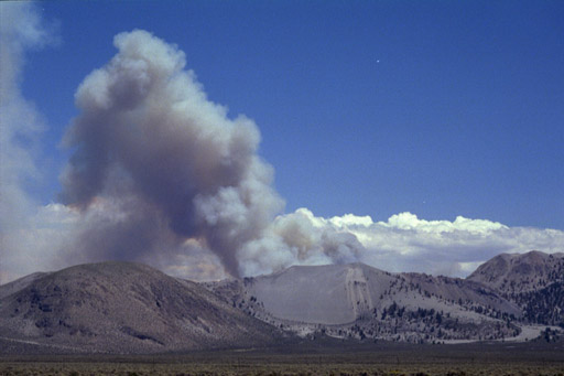
Forest fire behind the Mono Craters

Forest fire behind the Mono Craters