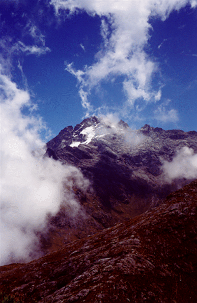
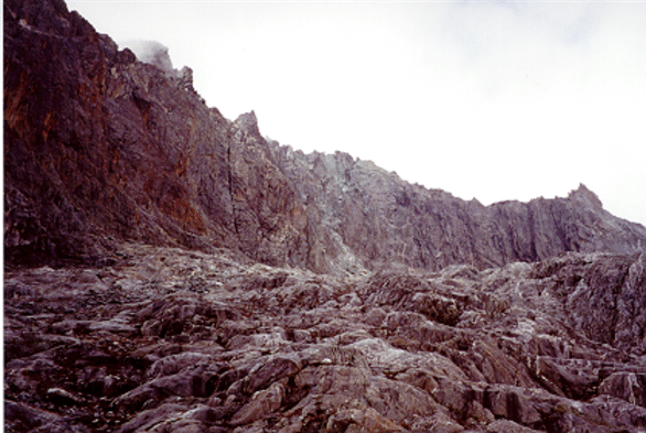
Pico Bolivar North Face
I flew to Caracas, Venezuela on March 16th, 2000. I stayed for a day in Caracas and flew to Merida, my base camp for Pico Bolivar, on March 17th. Merida is a nice Andean city built on a plateau between the two highest mountain ranges in Venezuela: Sierra Nevada and Sierra La Culata. The city lives from the prestigious Universidad de los Andes and tourism. However, the tourist industry was suffering a lot from the December 1999 floodings. Even though the floodings happened hundreds of miles away from Merida and they didn't affect the city at all, most tourists steered away from the city. As a result, the city was relatively empty and most tourist attractions were closed or operating in "low-season" schedule.
My first task was to find a place to stay. I found a nice hostel (pension) near the cable car (Teleferico) and asked if they had a room. Hostel keepers in Venezuela don't take people they don't like (even if they have empty room), so after a careful "appraisal": What are you doing in Merida? Are you a quiet person?... I was offered a room. It was a nice room with a no-so-nice view to the city cemetery (but at least I had the most quiet neighbors that you can wish for).
I had contacted Arassari Trek in advance and I told them that I wanted a guided climb of Pico Bolivar and Pico Humboldt. Their answer was that I had a guaranteed departure and that they were looking forward to my visit. However, when I showed up, it turned that they couldn't find any additional clients to go to Pico Bolivar, and they asked me to wait a few days until they could find more people to join the climb. To be fair, I have to say that this was the las problem that I had with Arassari Trek. After that point, they were very professional and their service was excellent.
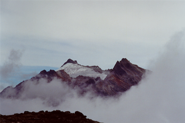
Given that I couldn't leave for Pico Bolivar, the owner of Arassari planned for me an acclimatization hike to "Alto de la Cruz" (The high of the Cross) on March 18th. This involved taking the cable car to the "La Aguada" station at 3453m (11329ft), hiking to the next station "Loma Redonda" (which was closed) at 4045m (13272ft) and then hiking to alto de la Cruz at about 4250m (13700ft). From that highpoint, I was able to see the summit of Pico El Toro (4756m, 15603ft) and Pico Bolivar (5007m, 16427ft). From there, I hiked down to the isolated town of Los Nevados from which I took a 4-hour long, bumpy, and scary ride in a "jeep" back to Merida.
On Sunday March 19, I took a rest day and went to some hot springs North of Merida. I took a public bus to the town of Mucuchies and hike about 3km to the hot springs. These hot springs were nice, but they were a lot of people in the area. There was also a very nasty bull around, that chase away more than one victim that unknowingly went behind a bush to change clothes. I wanted to go to Laguna de Mucuchies, but the public transportation was extremely frustrating and after losing an hour trying to catch a bus (they were completely full and they won't even stop), I just decided to go back to Merida.
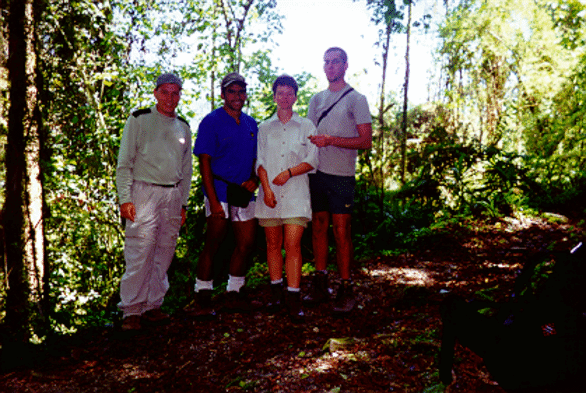
Finally, on Monday March 20st, Arassari found two more people and set up the trip to Bolivar (they dropped Humboldt because of time issues from the guide). My companions were Stefan Hausmann from Germany, Maika Drillich from England, and the fearless leader Dilfran. After setting up all the equipment, we were taken by jeep to the National Park Sierra Nevada, where we started our adventure towards Pico Bolivar.
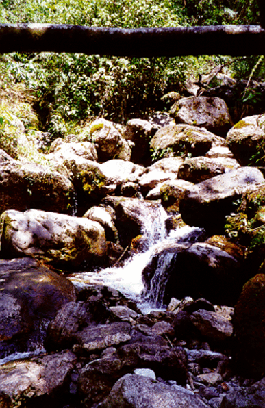
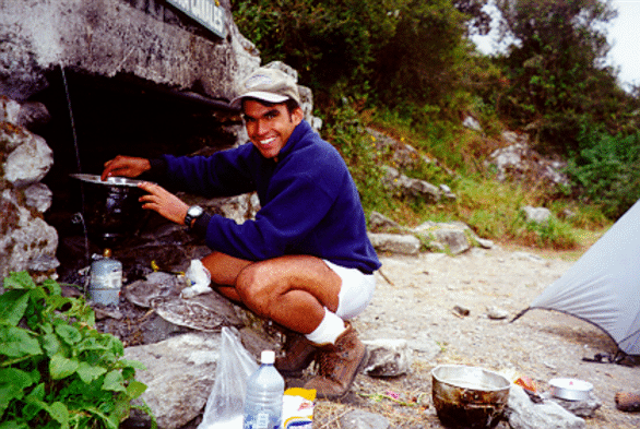
La Mucuy entrance at 2130m (6988ft) is located in a tropical cloud forest. Tall trees competing for the light and bamboo forest shares the way with nice creeks and waterfalls. Dilfran, the leader, started at a very slow pace, increasing it until the group started to lagged behind, then he will keep the pace, just a notch under that pace, keeping the group comfortable, but at the same time moving fast.

After 4 hours of hiking, we arrived to the green transparent clear Laguna Coromoto at the exit of the woods. We set up camp (3200m, 10499ft) and Dilfran prepared a wonderful dinner of rice and chicken. At night, we were visited by a "lapa" (Agouti paca). This interesting looking animal looks like a big rabbit but with short ears and large red eyes. The lapa had a a reddish chestnut fur with white horizontal stripes and spots along the sides of the body. The lapa wasn't afraid of us and walk freely around camp checking for any leftovers from our dinner. However, the moment I walked to my tent to fetch my camera, the animal got camera-shy and we didn't see it again.
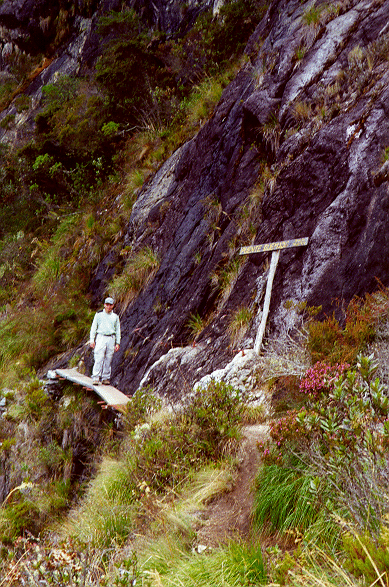
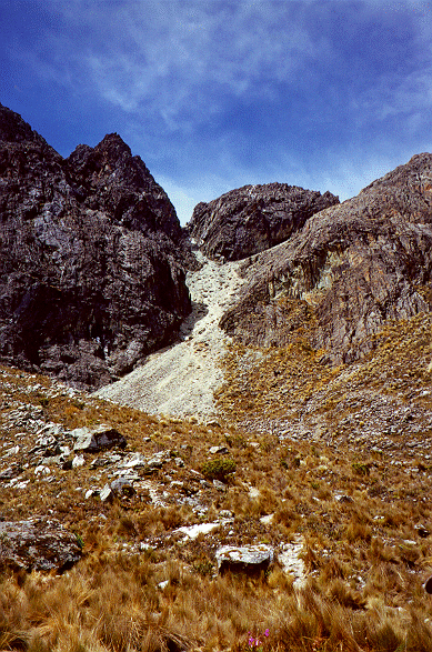
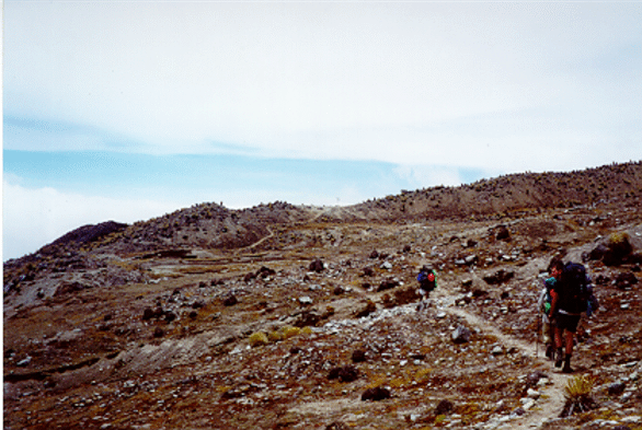
March 22nd: From Laguna Coromoto, we left the easy trail in the tropical forest and we started to hike through a rocky and steep terrain. We passed "el puente quemado" (the burnt bridge), just a wooden plank supported by long metal rods attached to a slab that would be impassable otherwise. After that point, we followed a steep path that required some class 2-3 short moves to get over huge rocks from the glacial period.
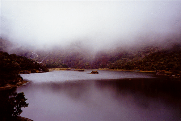
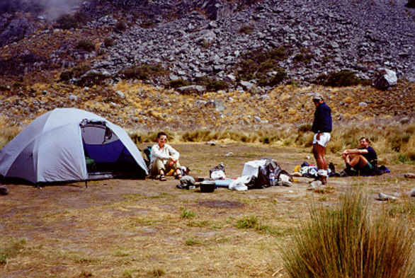
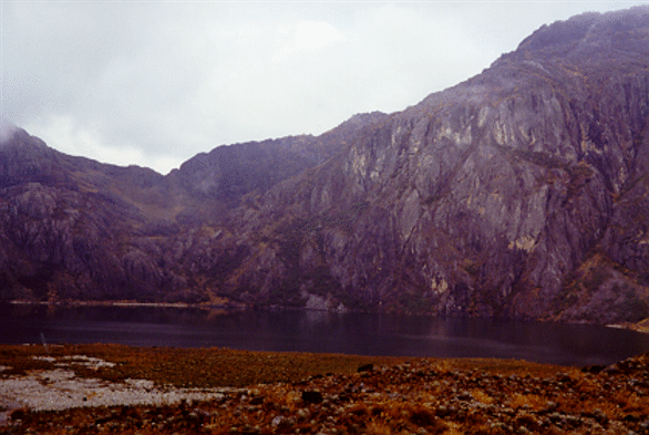
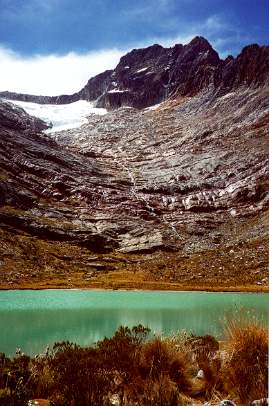
After a few hours of hiking and scrambling, we got to Laguna Verde (4000m, 13123ft) where we set up camp. From camp, the Humboldt and Bonpland peaks can almost be touched and the glacier between them was shining under the tropical sun.
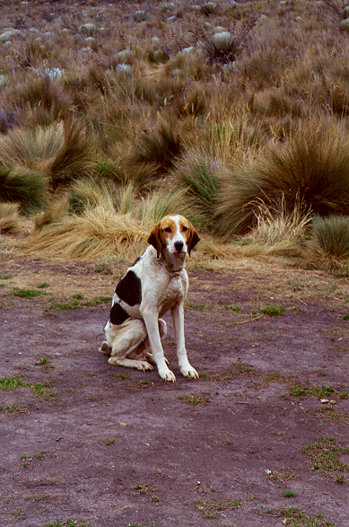
We got an interesting visitor at our camp: a dog. This poor dog, that Dilfran called Firulai, was starving... Firulai knew that we were carrying a lot of food, but, instead of begging or trying to get the food, he just patiently sat down and waited for the scraps of our dinner. Dilfran told us that wild dogs used to be a big problem in this trail and that the rangers had to exterminate them to protect the local fauna. Our visiting dog was spared as it was too old to hunt and his only source of food were the occasional hikers passing through. The dog followed us all the way to the start of the technical climb, waiting patiently every night for any scraps that we may have for him.
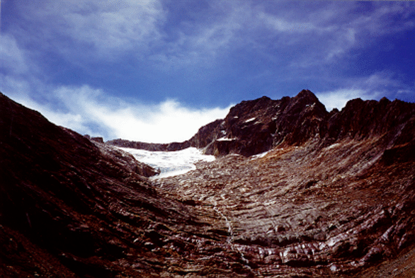
March 23rd: This was probably the hardest day of all. From Laguna Verde we hike west to laguna El Suero and face a steep uphill on loose rocks called "Chumahoma" (or xumajoma).
 |
 |
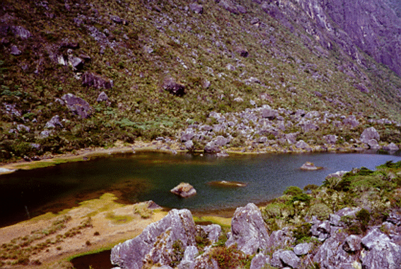
| Humboldt and Laguna del Suero | Chumahona |
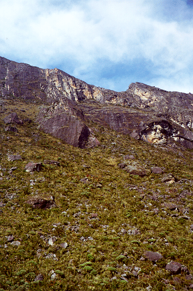
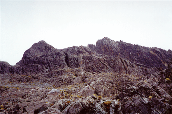
Once on top of Chumahoma, we enjoyed excellent views of the Sierra Nevada
crest. This was the start of a long high-altitude traverse. We hiked over
an easy but rocky landscape.
According to Dilfran, we had a very unusual weather. Normally, the view to
the South (towards "Los Llanos," the flatlands) is clear; and the view to
the North (towards "Sierra de la Culata") is cloudy. In our case, it was
the opposite. A growing worry of Dilfran was the lack of water. Merida
(as opposed to the North-central area of the country) had faced a drought
that completely melted what was left of the Timoncito glacier and allowed
for very little snow at the top of the mountains. Now that we were in the
South face of the Sierra Nevada, every creek we passed was dry.
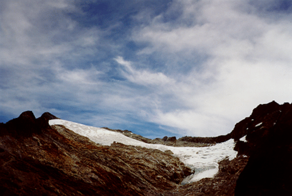
We set up camp just below Laguna Timoncito (4450m, 14600ft) but
surprisingly the nearby creek was also dry.
Maika and Stefan were feeling the effects of the elevation, so they took a
nap in the tent, while Dilfran and I hike up to a lake, Laguna Timoncito
(4600, 15092ft) where we got water for the group.

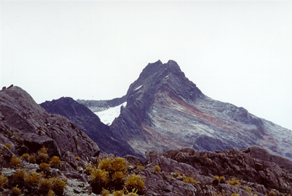
That night, Dilfran share with us the story of the five white eagles, the mythical legend that explains the creation of the five high peaks of the Venezuelan Andes. The story starts a long time ago when five white eagles came from the stars. With they enormous bodies, they flew over the hills and mountains of the Sierra Nevada casting their shadows on the land. Those were also the times when the first woman of the Mirripuyes tribe, Caribay, daughter of the Sun (Zuh�) and the Moon (Ch�a) was on earth, running like the wind on the hills of the Andes. One day, Caribay saw the eagles and she started coveting their white feathers. She started running after the eagles, but the closer she got, the higher the eagles flew. She kept pursuing the eagles, until finally, each of the tired eagles stop at each of the highest peak of the Sierra. When Caribay tried to get their feathers, the scared eagles started to move their wings, but there were so high that they couldn't fly. The eagles tried and tried, but they just couldn't take off. They tried even harder and the monstrous effort tore down their feathers from their wings that fell on the peaks as snow flakes. The cold of the night froze the eagles that collapsed on the peaks, becoming glaciers. This is the legend of the creation the five highest peaks in the Venezuelan Andes: Bol�var (5007m), Humboldt/Bonpland (4942m), La Concha (4922m), El Toro (4775m) and El Le�n (4743m). Today, only the North face of Bolivar and Humboldt/Bonpland are covered by glaciers. The other peaks have lost their white cover...
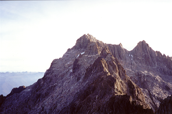
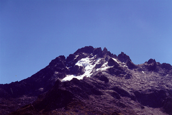
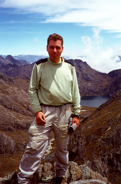
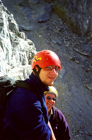
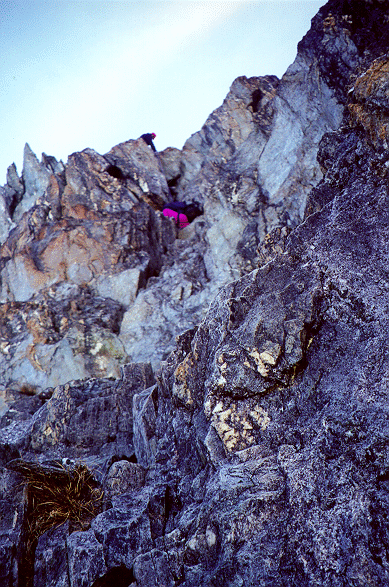
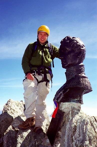
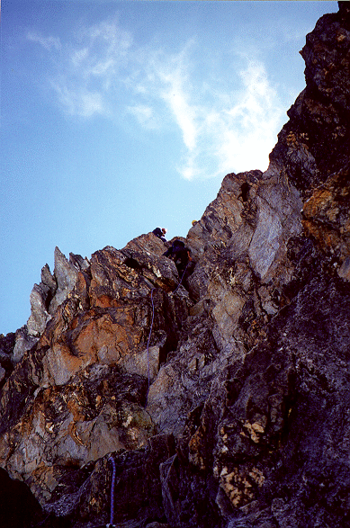
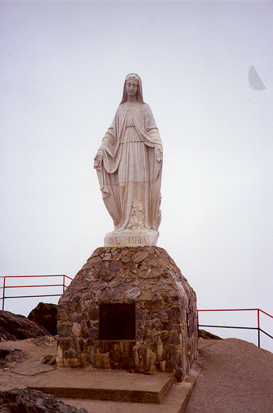
March 24th: This was the big climbing day. We set up our harnesses, rope, and helmets and headed to the top of Venezuela, Pico Bolivar. The climb is not particularly difficult (5.0-5.4) but the rock is loose, it has a lot of exposure and at that altitude the lack of oxygen can be felt. The hike has nicely bolted belay stations and it's clearly marked with painted blazes and cairns. Climbing inside the chute on rotten rock was a scary affair. We were climbing pretty close to each other to minimize the danger of rock fall and I was happy that there wasn't another team ahead of us: I never liked feeling like a bowling pin... After scrambling (and climbing on chockstones), we reached a notch that, through a catwalk, took us to the North Face of Bolivar. The final pitch (5.4 in my opinion) was wonderful with good solid rock and extremely airy. At the compact summit, a bigger than life-size bust of Simon Bolivar, El Libertador (the liberator) gazes down to the land he freed. Eleven thousand feet below, we could see the red tiled roofs of Merida, our starting point. After the obligatory summit pictures and the traditional scream of "Cumbre!!!" (summit!!!), we rappeled down to the catwalk and descended back to our camp. Given that we only have one rope, the descend was slow. First, I will rappel to the next station and anchored myself. Then, Dilfran would descend Stefan and Maika (who didn't know how to rappel). Finally, Dilfran would either rappel or downclimb unprotected the pitch.


Back to camp, I was so exhausted that I just drop in the tent and took a nap. After an hour, Dilfran woke me up and offered me a warm soup. After eating, I felt much better and after a short break, we started to lift camp. We headed to Pico Espejo, where we were expecting to find some Teleferico workers willing to take us down to Merida. The climb to Pico Espejo was interesting in its own, but after doing Pico Bolivar didn't seem that hard. We basically climb the peak through a chute named, "La Cloaca" (the sewer) as it used to be the place where the waste waters from the station were dumped. Fortunately, this practice stopped many years ago and the only evidence of the (infamous) past of this chute is its name. Unfortunately, we found at Pico Espejo (4765m, 15633ft) that there was nobody at the station and that it was too late to hike back to Merida. At 4800m, we didn't feel like spending the night outside, so we entered the station through an open window and spend the night inside.
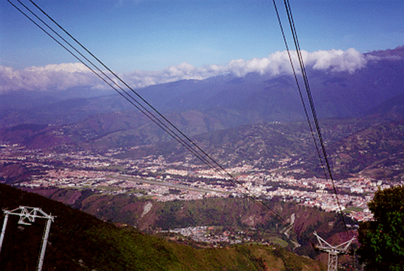
March 25th: We started the knee-killing descend to La Aguada. If the Cable car would have been working all the way to Pico Espejo, this will be only a leisure 90 minute ride back to Merida. But, without the cable car, we had to take a steep 5-hour knee-killing walk down to La Aguada, the last station opened in the cable car line. Despite its frequent (and random) "maintenance" closures, if you go to Venezuela, it's worth to find out if the cable car is running. This cable car is the highest (4765m, 15633ft) and longest (12.5km) in the world and it's one of the most important tourist attractions in the country. The cable car is divided in four segments, each culminating in a different station. Tourists are not allowed to ride the car all the way to the top in one shot, instead, people need to wait for the following cable car in each intermediate station so they gain a little bit of acclimatization. With the waits, it takes 90 minutes to 2 hours to get to the highest station, Pico Espejo. For people looking to extend their adventure, there are hiking and horse riding opportunities in each station, such as the one that I took my first day going to Los Nevados.
From La Aguada stations it was an easy ride down to the city. In our car, a street-wise teenager turned to be extremely acrophobic and it was funny to see an old lady (that would have probably crossed the street to avoid him down in the city), tease him... Back at Merida, I went to airport to catch the next flight out to Caracas. Unfortunately, my airline cancel (no explanation) my flight and after fighting first, and begging later, I was able to get a seat on a different airline. After a few days visiting my parents in Caracas, I flew back to the US.